

Tackling air pollution with open data
December 14, 2017
Private Sector and Open Street Maps
December 29, 2017
Mapping Nilkantha with Open Street Maps
Partner: Kathmandu Living Labs
Outcome area: Outcome 2 – Increasing the supply of open data in Nepal
To grow the availability of open mapping data and support evidence informed planning by local government actors, the D4D Program supported Kathmandu Living Labs to implement an OpenStreetMap project in Nilkantha municipality.
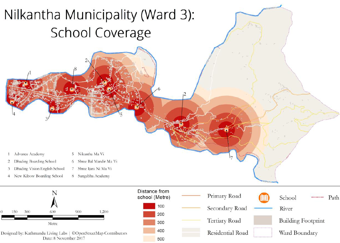
Open geospatial data has huge potential social and economic benefits resulting from the wide range of purposes for which it can be used. For example, among other uses, open mapping data can be used to support agricultural and water resource management, support decision making during an emergency, and support the location of government services such as schools and health clinics. While many parts of Kathmandu have been mapped, this has been less common outside of the capital. To help the generation and use of open mapping data, Kathmandu Living Labs worked with the local community of Nilkantha Municipality to map their town.
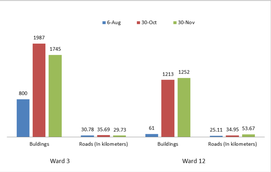
Kathmandu Living Labs conducted a series of orientations and sensitization workshops at three campuses and schools in Nilkantha Municipality. Throughout the workshops participants were taught about the basic concepts of mapping; the worldwide open mapping movement; use cases of mapping; and OpenStreetMaps as a tool for mapping their local community. The students were then engaged in field mapping in two wards – ward 3 and 12. To support this, Kathmandu Living Labs was able to leverage its partnership with FHI 360 to acquire recent high resolution satellite imagery of the areas.
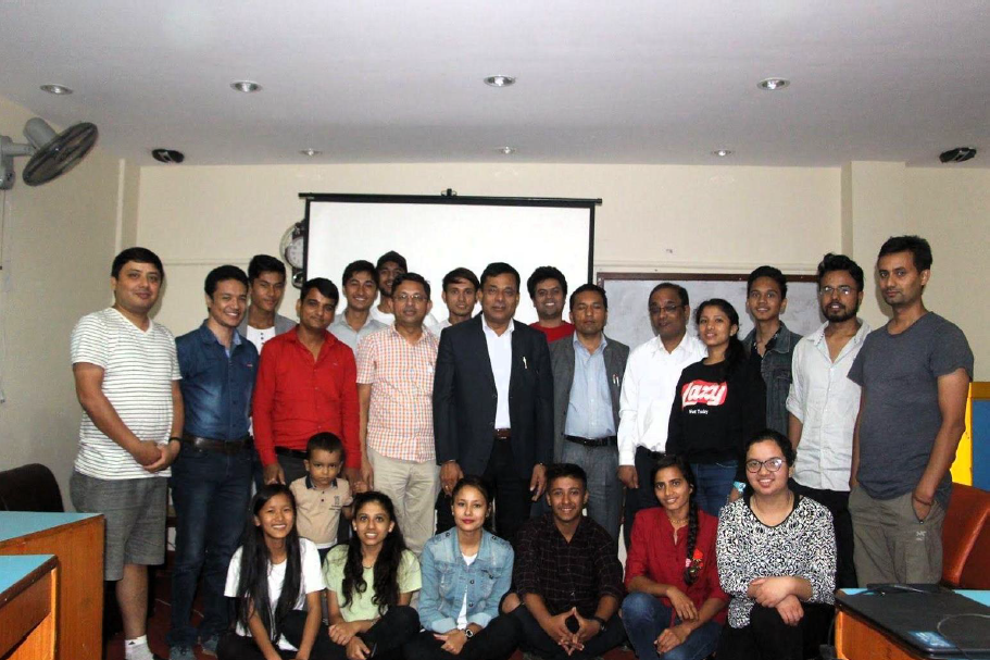
The results of the mapping exercise were then formally presented to the Mayor of Nilkantha through a workshop in December 2017 alongside the launch of the smart city app developed for Nilkantha municipality with funding from USAID’s Civil Society Mutual Accountability Program. The app features information about municipality staff and services. The OSM map developed under the D4D Program forms the base map of the app and helps users find the location of specific services and key municipal infrastructure.
For more information please access the Nilkantha Smart City app – Mero Nilkantha Mero Mobile – here.

